$240
Description
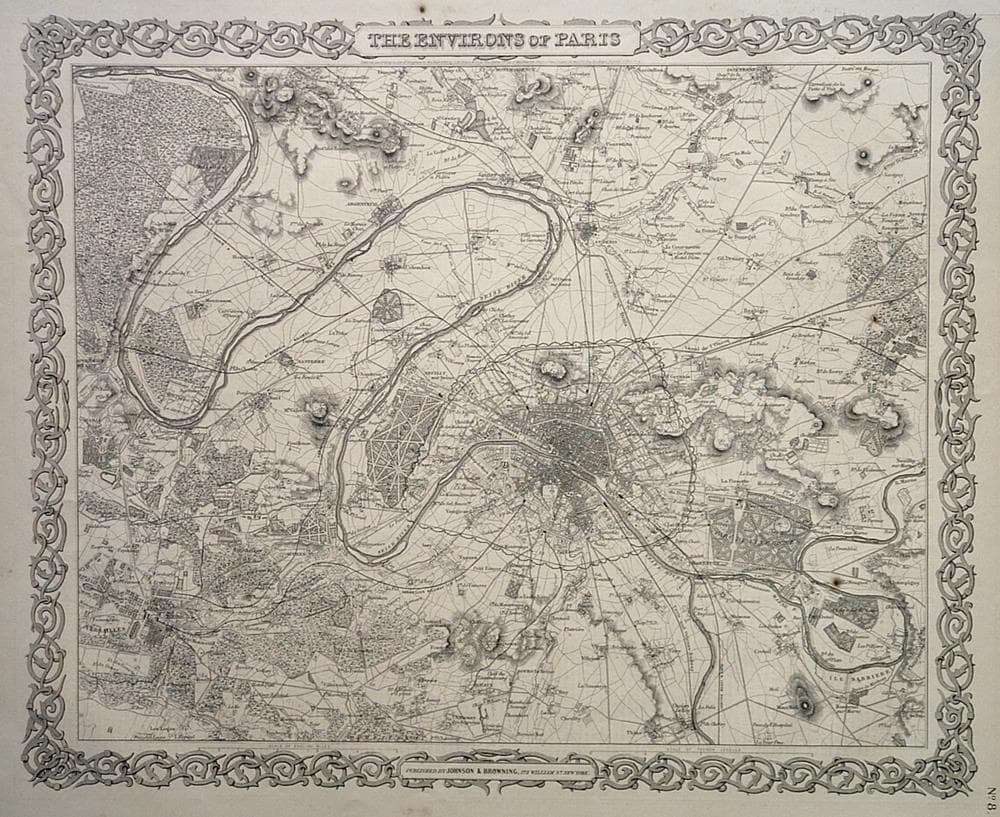
Precise steel plate engraving with remarkable detail throughout. J H Colton’s decorative strapwork border sets the map apart.
Two small spots; browning throughout
Year1855
Item#1042
ConditionVG+
DESCRIBING A MAP’S CONDITION IS HIGHLY SUBJECTIVE. ART POST USES A RATING SYSTEM COMMON TO MAP DEALERS THROUGHOUT THE WORLD:
- Very Fine (VF) – Map is clean and bright with a strong image.
- Fine (F) – Map generally has a clean, sharp image. Flaws and repairs are noted.
- Very Good (VG) – Map has no significant imperfections, though paper quality and margin size may vary. Minor flaws such as wormholes, age toning, or a centerfold separation not affecting the image may be present.
- Good (G) – Map bears noticeable imperfections but remains in collectible condition. Foxing, a weak map image, and/or a wide centerfold separation are described.
All maps sold by Art Post are in collectable condition.
Size 13" x 16"
RegionEurope
Bio Alvin Jewett Johnson and Ross C. Browning
Alvin Jewett Johnson (1827 - 1884) was a prolific American map publisher active from 1856 to the mid 1880s. Johnson was born into a poor family in Wallingford, Vermont where he received only a basic public education. He is known to have worked as school teacher for several years before moving to Richmond, Virginia. The earliest Johnson maps were published with D. Griffing Johnson (no clear relation) and date to the mid 1850s, however it was not until 1860 that the Johnson firm published its first significant work, the Johnson’s New Illustrated (Steel Plate) Family Atlas.
The publication of the Family Atlas followed a somewhat mysterious 1850’s deal with the well-established but financially strapped J. H. Colton cartographic publishing firm. Johnson and his partner Ross C. Browning (1832 - 1899), are thought to have bailed out the Colton firm in exchange for the right to use Colton’s existing copyrighted map plates. As a result, the first Johnson maps were mostly reissues of earlier Colton maps. Early on Johnson described his firm as the “Successors to J. H. Colton and Company”.
Johnson’s business strategy involved transferring the original Colton steel plate engravings to cheaper lithographic stones, allowing his firm to produce more maps at a lower price point. In 1861, following the outbreak of the American Civil War the Johnson and Browning firm moved their office from Richmond, Virginia to New York City. Johnson and Browning published two editions of the Johnson Atlas in 1860 and 1861.

