
Sold (Framed)
Description
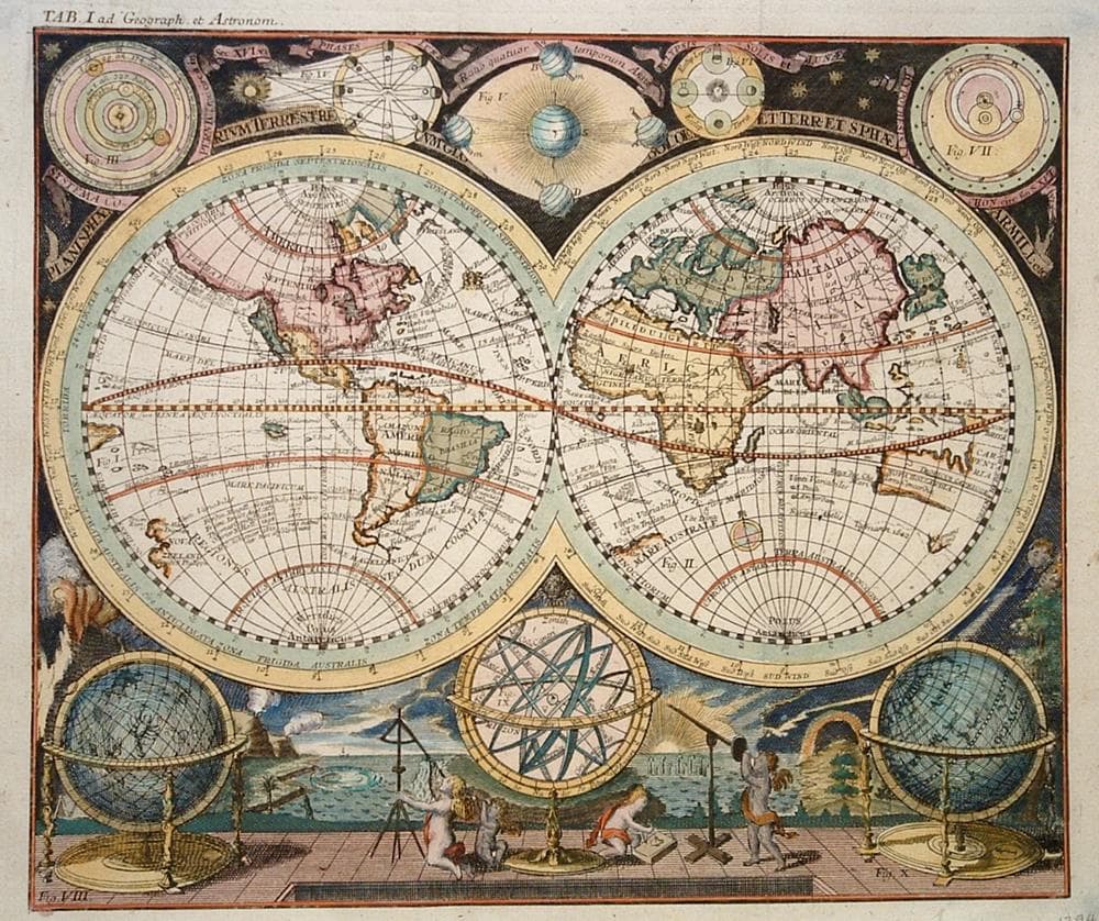
Double hemisphere map from Atlas Scholasticus a collaboration with Johann Baptist Homann, notably showing California as an island.
Year1712
Item#1404
ConditionVG
DESCRIBING A MAP’S CONDITION IS HIGHLY SUBJECTIVE. ART POST USES A RATING SYSTEM COMMON TO MAP DEALERS THROUGHOUT THE WORLD:
- Very Fine (VF) – Map is clean and bright with a strong image.
- Fine (F) – Map generally has a clean, sharp image. Flaws and repairs are noted.
- Very Good (VG) – Map has no significant imperfections, though paper quality and margin size may vary. Minor flaws such as wormholes, age toning, or a centerfold separation not affecting the image may be present.
- Good (G) – Map bears noticeable imperfections but remains in collectible condition. Foxing, a weak map image, and/or a wide centerfold separation are described.
All maps sold by Art Post are in collectable condition.
Size 18" x 19" (Framed)
RegionWorld
Bio
Johann Huebner (1668-1731) was a German geographer and scholar who taught by his own question and answer method. He was one of the first to teach the subject of geography in schools. His Questions and Answers to Geography, was published in 1693. His method using a system of letters on blank maps coded to a separate key list was employed in one of the earliest school atlases.
Huebner collaborated with the firm of Johann Babtist Homann in Nuremberg to publish the Atlas Scholasticus in 1732.


984 G Willow Road | Northbrook IL 60062
(Willow & Waukegan Roads — near Whole Foods)
Questions?
Gallery: 847-272-7659 or Cell/Text: 847-732-8148
Weekdays: 10:30 to 5:30 | Sat: 10:30 to 5:00 | Sun: 1:00 to 4:00
Email: artpostgallery@comcast.net
Never miss an important event, new arrivals or special offerings.
Sign-up for
our periodic announcements: