
“Mappe-Monde Dressee pour l’etude de la Geographie”
By Louis Brion de la Tour
close Previous Work Next Work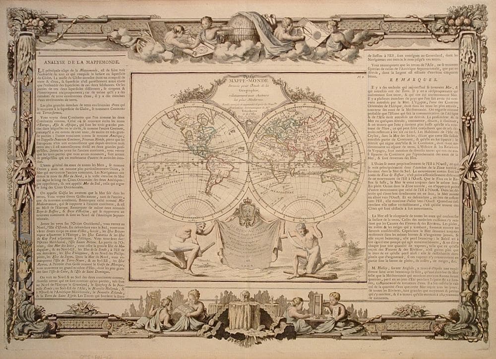
$200
Description
Printed using one plate for the map, another for the border with the text glued on later. Versions with different borders are known.
Some toning.
Year1766
Item#1122
ConditionG
DESCRIBING A MAP’S CONDITION IS HIGHLY SUBJECTIVE. ART POST USES A RATING SYSTEM COMMON TO MAP DEALERS THROUGHOUT THE WORLD:
- Very Fine (VF) – Map is clean and bright with a strong image.
- Fine (F) – Map generally has a clean, sharp image. Flaws and repairs are noted.
- Very Good (VG) – Map has no significant imperfections, though paper quality and margin size may vary. Minor flaws such as wormholes, age toning, or a centerfold separation not affecting the image may be present.
- Good (G) – Map bears noticeable imperfections but remains in collectible condition. Foxing, a weak map image, and/or a wide centerfold separation are described.
All maps sold by Art Post are in collectable condition.
Size 16" x 22"
RegionWorld
Bio
The Cartographer Royal to the King of France, officially “Ingenieur-Geographe du Roi”, Louis Brion de la Tour (1756-1823) was a prolific cartographer. Although he has several important atlases and statistical studies to his name, little is actually known of his life and career. What is known is that much of his work was produced in collaboration with Danish royal Cartographer Louis Charles Desnos (1750 – 1790). His most notable work is generally regarded to be his 1766 Atlas General.


984 G Willow Road | Northbrook IL 60062
(Willow & Waukegan Roads — near Whole Foods)
Questions?
Gallery: 847-272-7659 or Cell/Text: 847-732-8148
Weekdays: 10:30 to 5:30 | Sat: 10:30 to 5:00 | Sun: 1:00 to 4:00
Email: artpostgallery@comcast.net
Never miss an important event, new arrivals or special offerings.
Sign-up for
our periodic announcements: