
“Essay d’une Carte Reduite, du Globe Terrestre”
By Jacques Nicolas Bellin
close Previous Work Next Work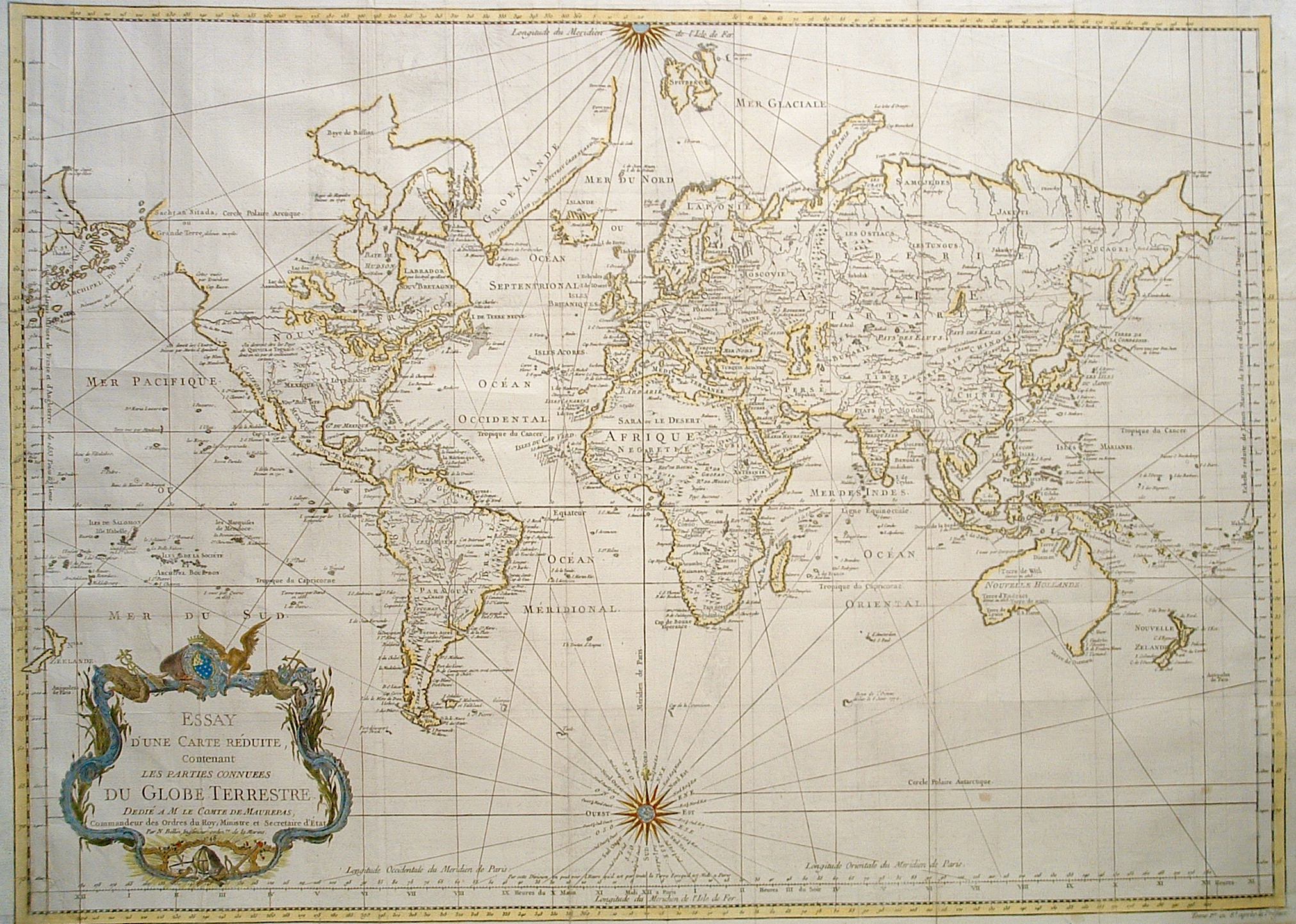
$1,200 (Unframed)
Description
Contains infamous phantom River of the West from Lake Superior to the Pacific as the Northwest Passage. Equally erroneous depictions of parts of New Hollande, Terre de Diemen and New Zealand.
Minor expert repairs.
Year1748
Item#1401
ConditionVG
DESCRIBING A MAP’S CONDITION IS HIGHLY SUBJECTIVE. ART POST USES A RATING SYSTEM COMMON TO MAP DEALERS THROUGHOUT THE WORLD:
- Very Fine (VF) – Map is clean and bright with a strong image.
- Fine (F) – Map generally has a clean, sharp image. Flaws and repairs are noted.
- Very Good (VG) – Map has no significant imperfections, though paper quality and margin size may vary. Minor flaws such as wormholes, age toning, or a centerfold separation not affecting the image may be present.
- Good (G) – Map bears noticeable imperfections but remains in collectible condition. Foxing, a weak map image, and/or a wide centerfold separation are described.
All maps sold by Art Post are in collectable condition.
Size 20" x 28" (Unframed)
RegionWorld
Bio
Jacques Bellin (1703 - 1772) served for over fifty years as the first `Ingenieur hydrographe de la Marine’ at the French Hydrographic Service. During his term of office, he was commissioned to carry out major surveys, first of the coast of France and later of all the known coasts of the world. These surveys resulted in the production of a large number of sea charts of the highest quality. They were issued in many editions with varying numbers of charts until the end of the century.
He was appointed Hydrographer to the King and was a member of the Royal society in London.


984 G Willow Road | Northbrook IL 60062
(Willow & Waukegan Roads — near Whole Foods)
Questions?
Gallery: 847-272-7659 or Cell/Text: 847-732-8148
Weekdays: 10:30 to 5:30 | Sat: 10:30 to 5:00 | Sun: 1:00 to 4:00
Email: artpostgallery@comcast.net
Never miss an important event, new arrivals or special offerings.
Sign-up for
our periodic announcements: