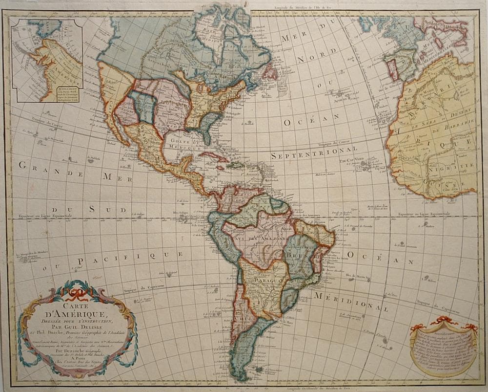
“Carte d’Amerique, Dressee pour L’Instruction…”
By Jean-Claude Dezauche
close Previous Work Next Work
$1,450
Description
This edition of the Delisle map of the Americas, first published in 1722, was extensively updated through numerous revisions. It includes the information from Cook’s discoveries in the Northwest and Alaska in an inset “Supplement a la Partie Nord Ouest de l’Amerique d’apres les Decouvertes du Capitaine Cook.” The newly independent United States extends to the Mississippi River in the west and to Florida in the south. In this edition the Privilege is changed from “du Roi” to “l’Auteur Rue des Noyers Garantie Nationale An. 9.” After the French Revolution the Royal arms were erased from the cartouche and replaced by ribbons, the king’s name was removed from the title, and the date (An 9) is the French Republican calendar for 1800.
Two small centerfold holes repaired.
Year1800
Item#1726
ConditionVG+
DESCRIBING A MAP’S CONDITION IS HIGHLY SUBJECTIVE. ART POST USES A RATING SYSTEM COMMON TO MAP DEALERS THROUGHOUT THE WORLD:
- Very Fine (VF) – Map is clean and bright with a strong image.
- Fine (F) – Map generally has a clean, sharp image. Flaws and repairs are noted.
- Very Good (VG) – Map has no significant imperfections, though paper quality and margin size may vary. Minor flaws such as wormholes, age toning, or a centerfold separation not affecting the image may be present.
- Good (G) – Map bears noticeable imperfections but remains in collectible condition. Foxing, a weak map image, and/or a wide centerfold separation are described.
All maps sold by Art Post are in collectable condition.
Size 19" x 24"
RegionAmerica's
Bio
Renowned for accurate, scientific precision in their cartography, French cartographers of the eighteenth century marked a change from their more artistically oriented predecessors. This was likely due to wider availability of more accurate data. JeanClaude Dezauche (1770-1824) and Phillipe Buache (1700-1773) were the successors to the influential Guillaume De L’Isle, and continued this scientific approach.
Dezauche acquired the work of De L’Isle and Phillipe Buache in 1780, having bought it from Jean Nicolas Buache de la Neuville, Phillipe’s nephew. Dezauche made his own alterations and improvements to the works based upon new information, and republished them in accordingly. His work is often mistaken for De L’Isle’s as a result.

