
$400
Description
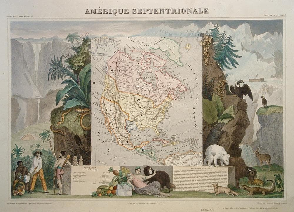
Richly engraved map showing the US claims in present day Canada, the Republic of Texas and Russia in control of Alaska. A Mayan temple, wildlife and a ship stranded in the polar sea highlight the map.
Minor wrinkle in top margin.
Year1845
Item#1714
ConditionVG+
DESCRIBING A MAP’S CONDITION IS HIGHLY SUBJECTIVE. ART POST USES A RATING SYSTEM COMMON TO MAP DEALERS THROUGHOUT THE WORLD:
- Very Fine (VF) – Map is clean and bright with a strong image.
- Fine (F) – Map generally has a clean, sharp image. Flaws and repairs are noted.
- Very Good (VG) – Map has no significant imperfections, though paper quality and margin size may vary. Minor flaws such as wormholes, age toning, or a centerfold separation not affecting the image may be present.
- Good (G) – Map bears noticeable imperfections but remains in collectible condition. Foxing, a weak map image, and/or a wide centerfold separation are described.
All maps sold by Art Post are in collectable condition.
Size 23" x 29"
RegionAmerica's
Bio
Victor Levasseur (1838-1854) was a French cartographer widely known for his distinctive decorative style. Produced numerous maps more admired for the artistic content of the scenes and data surrounding the map than for the detail of the map.


984 G Willow Road | Northbrook IL 60062
(Willow & Waukegan Roads — near Whole Foods)
Questions?
Gallery: 847-272-7659 or Cell/Text: 847-732-8148
Weekdays: 10:30 to 5:30 | Sat: 10:30 to 5:00 | Sun: 1:00 to 4:00
Email: artpostgallery@comcast.net
Never miss an important event, new arrivals or special offerings.
Sign-up for
our periodic announcements: