
$150
Description
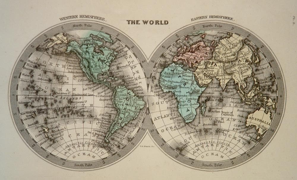
From Carey & Lea Family Cabinet Atlas, based on the British atlas of Thomas Starling.
Year1832
Item#1406
ConditionVG+
DESCRIBING A MAP’S CONDITION IS HIGHLY SUBJECTIVE. ART POST USES A RATING SYSTEM COMMON TO MAP DEALERS THROUGHOUT THE WORLD:
- Very Fine (VF) – Map is clean and bright with a strong image.
- Fine (F) – Map generally has a clean, sharp image. Flaws and repairs are noted.
- Very Good (VG) – Map has no significant imperfections, though paper quality and margin size may vary. Minor flaws such as wormholes, age toning, or a centerfold separation not affecting the image may be present.
- Good (G) – Map bears noticeable imperfections but remains in collectible condition. Foxing, a weak map image, and/or a wide centerfold separation are described.
All maps sold by Art Post are in collectable condition.
Size 4" x 6"
RegionWorld
Bio
P.E. Hamm was a cartographer who worked for Henry Charles Carey and Isaac Lea (Carey & Lea) in the middle of the nineteenth century in Philadelphia. Carey was a political economist. He illustrated the nations of the western hemisphere through maps that showed an expanding region with promise of developing into lands of great new opportunity and growth.
The Family Cabinet Atlas, "Revised, Corrected and Enlarged", issued in 1832, was based on a British atlas of the same name, but with the plates re-engraved. These maps contained an impressive amount of detail for such images. Their size and hand color makes them as charming as they are interesting.


984 G Willow Road | Northbrook IL 60062
(Willow & Waukegan Roads — near Whole Foods)
Questions?
Gallery: 847-272-7659 or Cell/Text: 847-732-8148
Weekdays: 10:30 to 5:30 | Sat: 10:30 to 5:00 | Sun: 1:00 to 4:00
Email: artpostgallery@comcast.net
Never miss an important event, new arrivals or special offerings.
Sign-up for
our periodic announcements: