
$690
Description
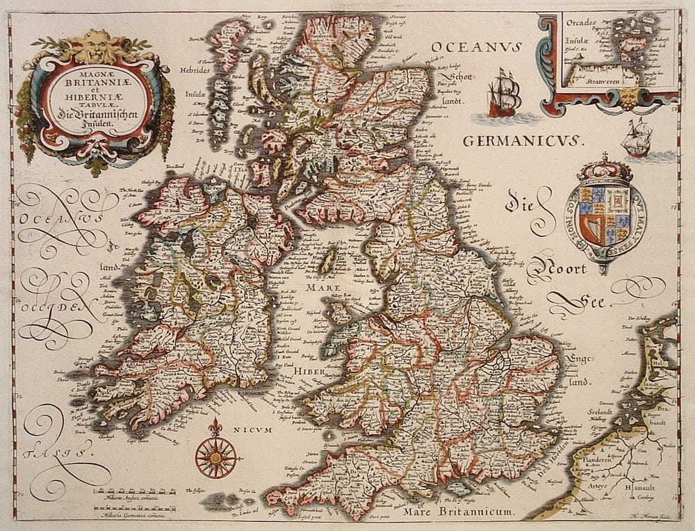
Based on Blaeu’s similar map. Merian’s signature appears at bottom right.
Year1641
Item#1180
ConditionF
DESCRIBING A MAP’S CONDITION IS HIGHLY SUBJECTIVE. ART POST USES A RATING SYSTEM COMMON TO MAP DEALERS THROUGHOUT THE WORLD:
- Very Fine (VF) – Map is clean and bright with a strong image.
- Fine (F) – Map generally has a clean, sharp image. Flaws and repairs are noted.
- Very Good (VG) – Map has no significant imperfections, though paper quality and margin size may vary. Minor flaws such as wormholes, age toning, or a centerfold separation not affecting the image may be present.
- Good (G) – Map bears noticeable imperfections but remains in collectible condition. Foxing, a weak map image, and/or a wide centerfold separation are described.
All maps sold by Art Post are in collectable condition.
Size 10.5" x 14"
RegionBritish Isles
Bio
Matthaus Merian (1693-1650) “the Elder” was a notable Swiss engraver born in Basel. He worked and studied in Germany and France before moving to Frankfurt where he inherited his father-in-law’s publishing house in 1623. There he produced numerous very detailed and stylized town plans of German and Swiss towns. Together with his son Matthaus Merian (1621-1687) “the Younger”, he produced a 21 volume Topographia Germaniae containing a large number of town plans and views, maps of most known countries and a World Map. He also completed the later parts and editions of Grand Voyages and Petits Voyages begun by is father-in-law Johann Theodor de Bry in 1590.


984 G Willow Road | Northbrook IL 60062
(Willow & Waukegan Roads — near Whole Foods)
Questions?
Gallery: 847-272-7659 or Cell/Text: 847-732-8148
Weekdays: 10:30 to 5:30 | Sat: 10:30 to 5:00 | Sun: 1:00 to 4:00
Email: artpostgallery@comcast.net
Never miss an important event, new arrivals or special offerings.
Sign-up for
our periodic announcements: