
Sold
Description
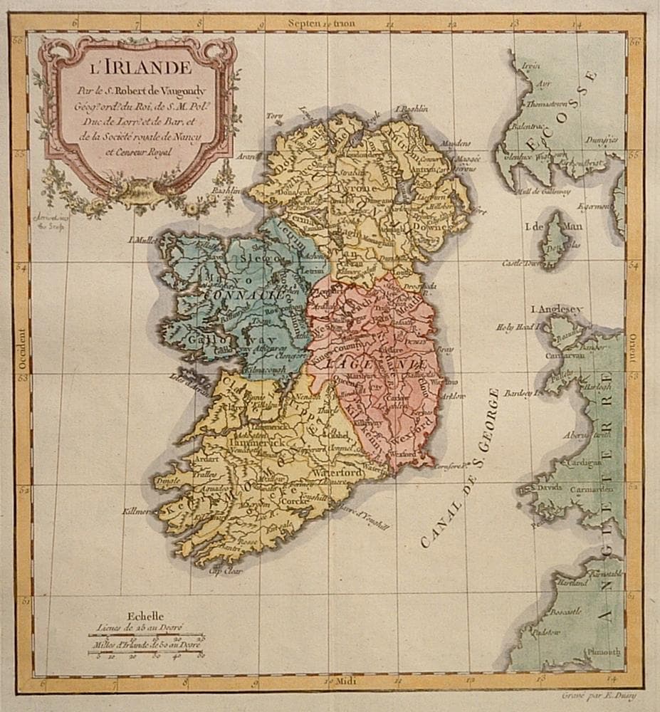
The second state of the map engraved by E. Dussy with “et Censeur Royal” added to the decorative title cartouche.
Wide margins.
Year1778
Item#1371
ConditionF
DESCRIBING A MAP’S CONDITION IS HIGHLY SUBJECTIVE. ART POST USES A RATING SYSTEM COMMON TO MAP DEALERS THROUGHOUT THE WORLD:
- Very Fine (VF) – Map is clean and bright with a strong image.
- Fine (F) – Map generally has a clean, sharp image. Flaws and repairs are noted.
- Very Good (VG) – Map has no significant imperfections, though paper quality and margin size may vary. Minor flaws such as wormholes, age toning, or a centerfold separation not affecting the image may be present.
- Good (G) – Map bears noticeable imperfections but remains in collectible condition. Foxing, a weak map image, and/or a wide centerfold separation are described.
All maps sold by Art Post are in collectable condition.
Size 9" x 9"
RegionBritish Isles
Bio Gilles Robert de Vaugondy (1688-1766) and Didier Robert De Vaugondy (1723-1786) were father and son, respectively. Nephew to Pierre Moulard Sanson, Gilles was successful in utilizing the records and materials of the Sanson family. As they often did not use the initials of their first names on their maps, it can be difficult to determine who made a given map. On some maps fils or filio follows the name, in other instances, the author can be determined by the distinctive way each signed his maps: Gilles normally used "M.Robert," without a last name, and Didier, "Robert de Vaugondy."
The Atlas Universal, jointly published in Paris in 1757, took 15 years to produce in two versions, 601 copies on large paper and 517 on small paper. It was one of the most important 18th century atlases. The Vaugondy's employed strict standards for including maps in the atlas and in many cases subjected them to astronomically derived readings for latitude and longitude. Moreover, they used eighteenth century sources to provide their atlas with up-to-date information. Like Ortelius and Mercator before them, the Vaugondy`s listed the sources of their maps.
The cartouches of the maps of the Atlas Universel were highly praised at the time and since. A number of artisans worked on their design and engraving; several were engraved and signed by the Haussard sisters. Among the most pictorial cartouches are found on maps showing the postal routes of Great Britain, France, Germany, Spain and Portugal. They depict postal carriers en route in richly detailed settings.


984 G Willow Road | Northbrook IL 60062
(Willow & Waukegan Roads — near Whole Foods)
Questions?
Gallery: 847-272-7659 or Cell/Text: 847-732-8148
Weekdays: 10:30 to 5:30 | Sat: 10:30 to 5:00 | Sun: 1:00 to 4:00
Email: artpostgallery@comcast.net
Never miss an important event, new arrivals or special offerings.
Sign-up for
our periodic announcements: