
“Gallia Nova et accurata descriptio vulgo Royaume de France”
By Jan Jannson
close Previous Work Next Work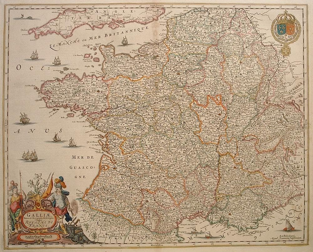
$700
Description
Fine map of France with French coat of arms and attractive cartouche
Light stain upper centerfold.
Year1660
Item#1281
ConditionG+
DESCRIBING A MAP’S CONDITION IS HIGHLY SUBJECTIVE. ART POST USES A RATING SYSTEM COMMON TO MAP DEALERS THROUGHOUT THE WORLD:
- Very Fine (VF) – Map is clean and bright with a strong image.
- Fine (F) – Map generally has a clean, sharp image. Flaws and repairs are noted.
- Very Good (VG) – Map has no significant imperfections, though paper quality and margin size may vary. Minor flaws such as wormholes, age toning, or a centerfold separation not affecting the image may be present.
- Good (G) – Map bears noticeable imperfections but remains in collectible condition. Foxing, a weak map image, and/or a wide centerfold separation are described.
All maps sold by Art Post are in collectable condition.
Size 18" x 22"
RegionEurope
Bio
Jan Jansson (1588 – 1664) the son of a bookseller and publisher who had worked with Jodocus Hondius Sr., married Jodocus’ daughter Elisabeth in 1612. In direct competition with the Blaeu’s, he and his brother-in-law Henry re-issued the Mercator-Hondius Atlas beginning in 1633. They redrew or replaced many of the maps in the original atlas. After the death of Henry, Jansson continued the business and expanded the Atlas into the Atlas Novus. This work was highly regarded but overshadowed by the Blaeu family works.
Jansson also issued a revised reprint of Braun and Hogenberg’s Civitates Orbis Terrarum, retaining many of the existing plates, but also adding a number of new ones. Other atlases that he published include Andreas Cellarius’ celestial atlas and George Hornius’ classical atlas.


984 G Willow Road | Northbrook IL 60062
(Willow & Waukegan Roads — near Whole Foods)
Questions?
Gallery: 847-272-7659 or Cell/Text: 847-732-8148
Weekdays: 10:30 to 5:30 | Sat: 10:30 to 5:00 | Sun: 1:00 to 4:00
Email: artpostgallery@comcast.net
Never miss an important event, new arrivals or special offerings.
Sign-up for
our periodic announcements: