
“Carte Generale de Toutes les Parties Connues de la Surface de la Terre…”
By Rigobert Bonne
close Previous Work Next Work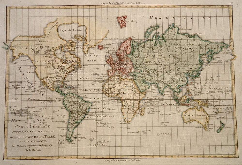
$270
Description
Attractive world map accurate for its era. Depicting Tasmania attached to Australia, Greenland attached to Canada and the Terre de Sandwich southeast of South America.
Wide margins.
Year1780
Item#1378
ConditionVG
DESCRIBING A MAP’S CONDITION IS HIGHLY SUBJECTIVE. ART POST USES A RATING SYSTEM COMMON TO MAP DEALERS THROUGHOUT THE WORLD:
- Very Fine (VF) – Map is clean and bright with a strong image.
- Fine (F) – Map generally has a clean, sharp image. Flaws and repairs are noted.
- Very Good (VG) – Map has no significant imperfections, though paper quality and margin size may vary. Minor flaws such as wormholes, age toning, or a centerfold separation not affecting the image may be present.
- Good (G) – Map bears noticeable imperfections but remains in collectible condition. Foxing, a weak map image, and/or a wide centerfold separation are described.
All maps sold by Art Post are in collectable condition.
Size 9" x 14"
RegionWorld
Bio Rigobert Bonne (1729 – 1795) served as Royal Hydrographer and as a result produced primarily marine charts. However, he also issued a number of other works including maps by fellow cartographers. Additionally, he produced maps for an atlas by Guillaume Raynal and for a Historical Atlas and Encyclopedia published with Nicholas Desmaret.


984 G Willow Road | Northbrook IL 60062
(Willow & Waukegan Roads — near Whole Foods)
Questions?
Gallery: 847-272-7659 or Cell/Text: 847-732-8148
Weekdays: 10:30 to 5:30 | Sat: 10:30 to 5:00 | Sun: 1:00 to 4:00
Email: artpostgallery@comcast.net
Never miss an important event, new arrivals or special offerings.
Sign-up for
our periodic announcements: